

Discover high-value mineral targets
Madini is an AI-powered mineral prospectivity mapping platform for Africa. We transform satellite imagery, geophysical data, and machine learning into ranked exploration targets for gold, copper, lithium, and silver — delivered in hours, not months.
What you get
From raw data to exploration targets
Built on peer-reviewed methods, fully reproducible, and documented end to end so you can check every step.
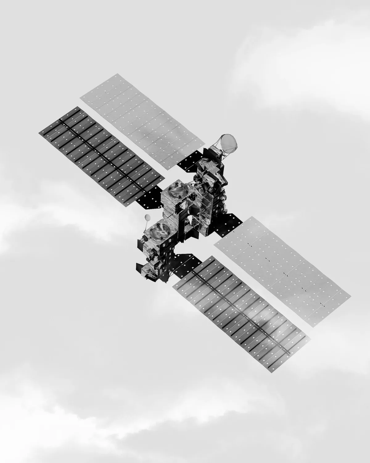
Satellites at Your Fingertips
Sentinel-2, ASTER, EMIT hyperspectral, elevation, and geophysical data — all fused into one analysis without you lifting a finger.

See What the Eye Cannot
Iron oxide, hydroxyl, sericite, and chlorite mapped from orbit — revealing alteration signatures invisible on the ground.

AI That Thinks Like a Geologist
Deposit-model weights encode what a geologist looks for — every evidence layer weighted by deposit type, then combined by weighted linear combination and fuzzy logic.

Targets, Ranked for You
Prioritised exploration targets, PDF reports, GeoTIFF rasters, and GeoJSON polygons — ready for your GIS or stakeholders.
Simple process
How it works
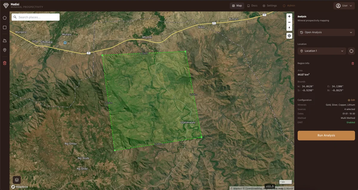
Define Your Region
We only need a few coordinates. Draw a polygon anywhere in Africa or select from saved locations. Choose your target minerals and configure analysis parameters.
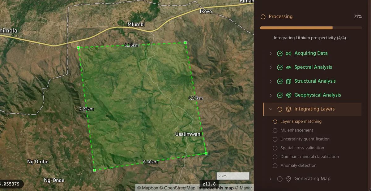
We Run an AI-Powered Analysis
Sit back while our pipeline ingests satellite imagery, maps alteration minerals, analyses structural geology, and weights every layer by deposit model — all automatically.
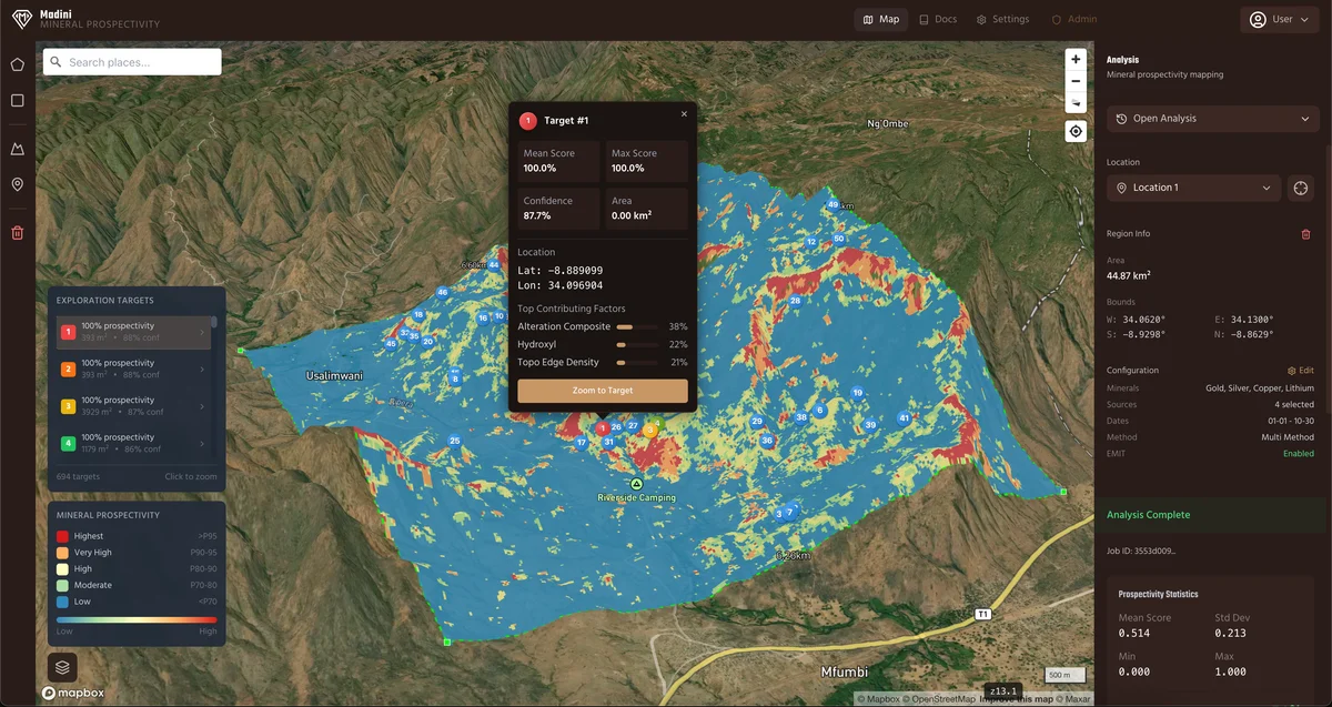
Explore & Export in 3D
Explore your results on an interactive 3D map, download ranked targets, and share publication-ready reports with your team.
Multiple commodities
One analysis, multiple minerals
Select one or more minerals and run a single analysis. Each commodity uses its own deposit model — no generic one-size-fits-all.
Gold
6 modelsThe dominant target across East and West Africa — from orogenic shear zones to epithermal systems.
Orogenic, Epithermal HS/LS, Supergene, Intrusion-related, Porphyry
Copper
7 modelsPorphyry to sediment-hosted — covering the full spectrum of copper deposit types.
Porphyry (2 variants), IOCG, VMS, SEDEX, Skarn, Manto
Lithium
2 modelsCritical mineral for the energy transition — hard-rock pegmatite and sedimentary clay deposits.
Pegmatite, Sedimentary clay
Silver
6 modelsOften co-occurring with gold and base metals — epithermal and polymetallic vein systems.
Epithermal Ag, Epithermal HS/LS, Polymetallic, CRD, VMS
More minerals coming soon — including nickel, cobalt, and rare earth elements.
Why Madini
Your benefits using madini
Peer-Reviewed Methods
Built on decades of published research — Rowan (1977), Ninomiya (2003), USGS spectral library. Every algorithm traceable to peer-reviewed literature.
Days, Not Months
What takes consultants weeks of manual GIS work, Madini delivers in days — at a fraction of the cost.
Geophysicist-Reviewed
Every analysis is reviewed by a professional geophysicist from the Geophysics Department of SolidiFi Mining before your report is signed off and delivered — a review of the work, not a check against drilling or assay results.
Honest About Its Limits
Every target is a screening rank within the area you submitted — not a calibrated probability, and not field-validated. Each one ships carrying that caveat.
Fits right in
Built for your workflow
Madini doesn't replace your process — it accelerates it. Results are delivered in formats your team already uses, ready to plug into your existing tools and reporting.
Drop Into Your GIS
GeoTIFF rasters and GeoJSON polygons load directly into QGIS, ArcGIS, or any standard GIS platform.
Plan Your Fieldwork
Ranked targets with coordinates and contributing factors — a screening shortlist for your field team, not a statement about what is in the ground.
Overlay Your Own Data
Combine Madini results with your proprietary geology, geochemistry, or drilling data in the interactive 3D viewer.
Share With Stakeholders
Publication-ready PDF reports with maps, methodology, and target rankings — hand them straight to investors or JV partners.
Ready to explore?
Your competitors are already mapping their next targets with AI. The longer you wait, the bigger their head start.